


The Headline Number
"Only Labour can win here." — Local election leaflet, England, May 2026 (as documented by Full Fact)
The Audit
No number appears in that claim. That's precisely the trick.
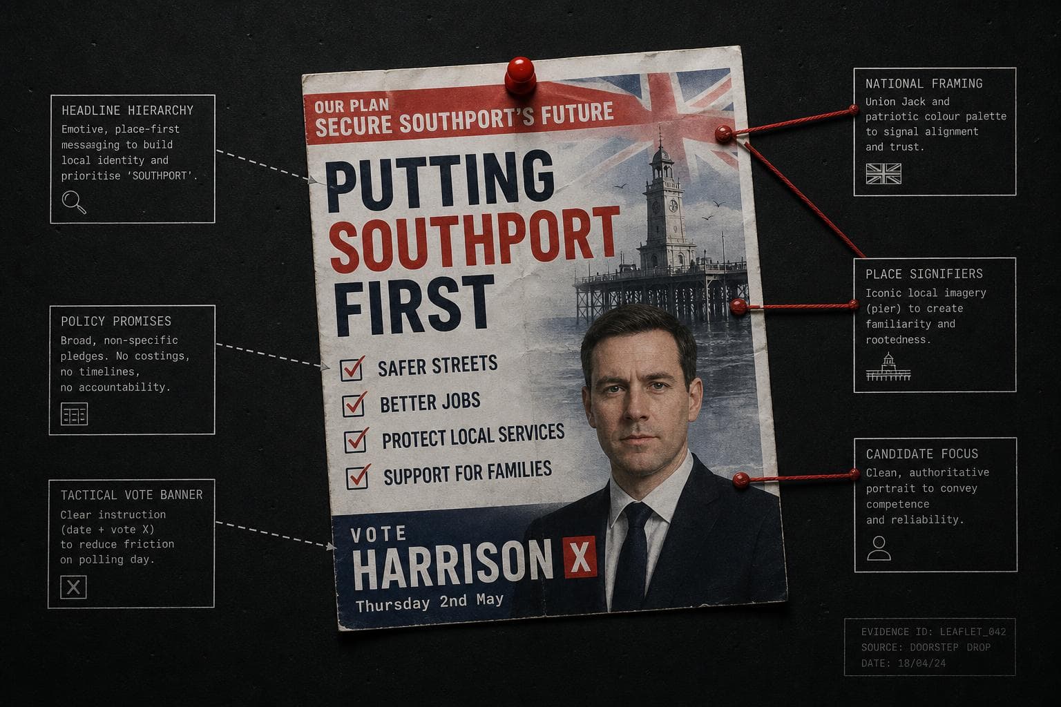
Full Fact's investigation of local election leaflets — analyzing materials uploaded to Democracy Club's archive in the first two weeks of April — found charts or graphics in more than 50 leaflets. At least 14 failed to provide reliable evidence for their core claim about likely local vote shares. The problems came from every major party. And the most common mechanism wasn't a fabricated number. It was a bar chart where the bars weren't proportional to the numbers they represented.
Read that again. The bars weren't proportional to the numbers. The visual argument and the data argument were different arguments, and the visual one won — because most readers process the picture, not the footnote.
This is the denominator problem's quieter cousin. With missing denominators, you're hiding the base. With distorted bar charts, you're hiding the scale. The effect is identical: a reader walks away with a quantitative impression that the underlying data doesn't support.
The deeper issue is that good local voting intention data often simply doesn't exist. Full Fact is careful to note this — there's nothing inherently wrong with parties using national polling or historical results as part of a pitch, if it's properly explained. Former YouGov chairman Peter Kellner put the standard plainly: any polling cited in a leaflet should disclose the date, nature, geographical coverage, and source. If it doesn't relate specifically to the ward being contested, say so.
Almost none of the leaflets met that standard.
What they did instead was import national polling data, dress it in a local bar chart, and let the visual do the inferential work the evidence couldn't. "Can't win here" is a strong claim. It requires ward-level data. A national poll rendered as a bar chart with non-proportional bars is not ward-level data. It's a mood board with a y-axis.
The 98.2% drug trafficking claim I covered two issues ago was a misuse of real CBP data — a two-month snapshot dressed up as a trend. The AI "95% failure rate" from last issue was a denominator error so severe it inverted the actual finding. This week's version is simpler and, in some ways, more insidious: the chart looks like local evidence. It has bars. It has party colors. It has a ward name at the top. The methodology is buried or absent.
Voters making tactical decisions — which is the explicit purpose of these leaflets — are being handed visual arguments built on national data, undisclosed sources, and geometry that doesn't match the numbers. That's not a design error. That's a persuasion strategy.
The fix is embarrassingly simple: label your source, label your geography, and make your bars proportional. The fact that this is rare tells you something about intent.
By the Numbers
14 — Leaflets out of 50+ analyzed by Full Fact that failed to provide reliable evidence for their local vote share claims. The number from all major parties, which means this isn't a partisan problem. It's an incentive problem.
25% — The actual pilot success rate buried inside the "95% AI failure" study, per 80,000 Hours' analysis.
Among companies that actually ran a pilot, one in four succeeded.